NASA Shares a New Stunning Image of Earth Taken by the NOAA-21 Satellite
As noted, the images of the Earth that make up this mosaic and several close-ups were captured on December 5 and 6 using an instrument called the Visible Infrared Imaging Radiometer Suite (VIIRS) aboard the NOAA-21 imaging satellite.

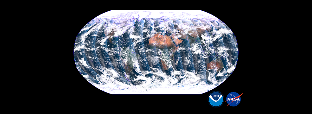
NASA's NOAA-21 imaging satellite, which was launched in November 2022, has taken a stunning global picture of our Earth from space. It shows turquoise seas around Cuba and an agricultural fire in Northern India.
As noted, the images of the Earth that make up this mosaic and several close-ups were captured on December 5 and 6 using an instrument called the Visible Infrared Imaging Radiometer Suite (VIIRS) aboard NOAA-21. It collects images in both visible and infrared light spectra, allowing scientists to see details of the Earth's surface.
The instrument gives experts important information about the planet's oceans, atmosphere, and land. It can detect differences in ocean color, telling scientists where phytoplankton are or whether dangerous algal blooms have formed along human-inhabited coastlines.
NOAA-21 is the second operational satellite that observes the entire surface of the Earth at once. It passes over the planet at an altitude of 824 km at about 27,360 km/h.