Europe's Latest Weather Satellite Took an Incredibly Detailed Image of Earth
Launched into space last December, the European Meteosat Third Generation Imager-1 is the first next-generation satellite set to revolutionize weather forecasting in Europe, according to the European Space Agency (ESA).

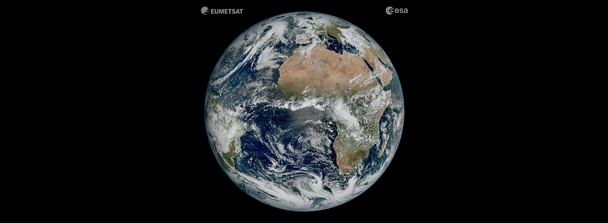
Europe's latest weather satellite, the Meteosat Third Generation Imager (MTG-I1), captured its first image of the Earth that shows conditions over Europe, Africa, and the Atlantic in striking detail.
Launched into space last December, the European Meteosat Third Generation Imager-1 is the first next-generation satellite set to revolutionize weather forecasting in Europe, according to the European Space Agency (ESA).
The first image of Earth from space made by MTG-I1 was taken on March 18, 2023, and shows much of Northern and Western Europe and Scandinavia blanketed in clouds, relatively clear skies over Italy and the Western Balkans, as well as all of Africa and the Atlantic Ocean. You can even see cloud vortices over the Canary Islands, snow cover on the Alps, and sediment in the water along the Italian coast.
Scientists believe this level of detail will allow better forecasting of the weather in Europe. According to scientists from ESA, no weather satellite has ever demonstrated such a level of detail in images.